Three methods
- Scratch-off poster — fun on the wall; region size depends on the product.
- Google My Maps — pins for places; regions don’t really get "colored in".
- City/county coloring app — Korea split into cities, counties and districts, with progress counted.
Korea scratch map
Scratching reveals where you’ve been, and it’s on the wall every day. It can’t be undone, it doesn’t record when or with whom, and the poster stays the same when administrative boundaries change.
Google My Maps
Great for pinning restaurants and hotels. It won’t color in "I’ve been to Gyeongju" as a region or tell you how many of the country’s areas you’ve seen.
City/county coloring app
These are real screens from the Android app "Korea Visited".
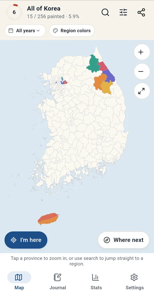
Tap a province to zoom, tap a city to log it
Tap a province on the national map to zoom in, then tap a city, county or district to open its visit card. Long-press to paint or clear it with today’s date. The top shows progress like "15 / 256 painted · 5.9%".
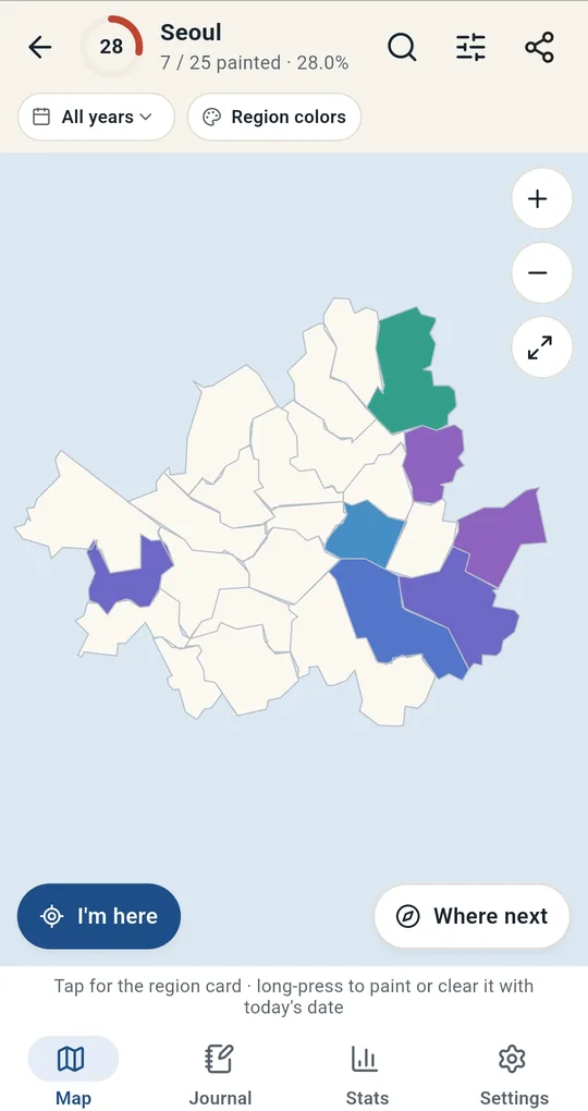
Inside a province
A province view shows only its areas, large, with its own progress such as "7 / 25 painted · 28.0%" for Seoul.
Side by side
| Scratch map | My Maps | Coloring app | |
|---|---|---|---|
| Unit | Varies | Pins | City/county/district |
| When and with whom | No | Notes | Date, companions, notes, photos |
| Progress | Eyeball it | No | Count and area % |
| Boundary changes | Not reflected | N/A | Updated in the app |
| On the wall | Best | No | Save as image |
FAQ
Do I need an account?
No. Records and photos are stored only on the device.
Does it cover other countries?
No, it covers South Korea only. For countries, see how to make a visited-countries map.
Is there an iPhone version?
It is currently available for Android on Google Play.
Korea Visited: Travel Map Log
No sign-up, and your trips and photos stay on your phone. Free on Android.