Decide what the map is for
- A keepsake for the wall — if scratching it by hand is half the fun, go with paper.
- One image to share — any method works; the question is how long it takes.
- A record that keeps growing — you need something easy to edit that also keeps dates.
Option 1: scratch-off map
A poster where you scratch off a foil layer to reveal each country. It is satisfying and looks good framed.
But a wrong scratch cannot be undone, small countries in Europe or the Caribbean are hard to scratch cleanly, and nothing records when or with whom you went.
Option 2: Google My Maps
On a computer, create a new map in Google My Maps, add a layer, and drop markers or draw shapes where you have been. It is free and easy to share as a link.
The catch: there is no "fill this country" button. You either trace borders by hand or find and import a border file (such as KML), which gets tedious as your list grows.
Option 3: a travel map app
Tap a country on your phone and it is colored. The screenshots below are from the Android app "Travel Map".
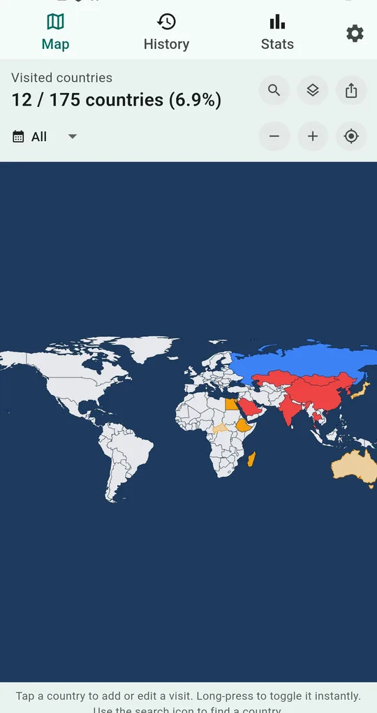
Tap a country on the map
Tap a country to open its visit record, or long-press to mark or unmark it instantly. Pinch to zoom for small island nations, or use the search icon to jump to a country by name.
Your visited count and percentage update at the top as you go.
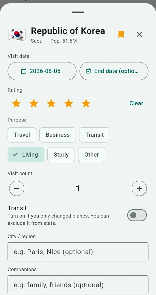
Add dates and details when you want
Each country can hold a visit date, rating, purpose (travel, business, transit, living, study, other), city or region and companions. The date starts as today, so change it to the real trip date. Everything else can stay empty and the country is still colored.
Details you add feed the stats and the year and rating color modes.
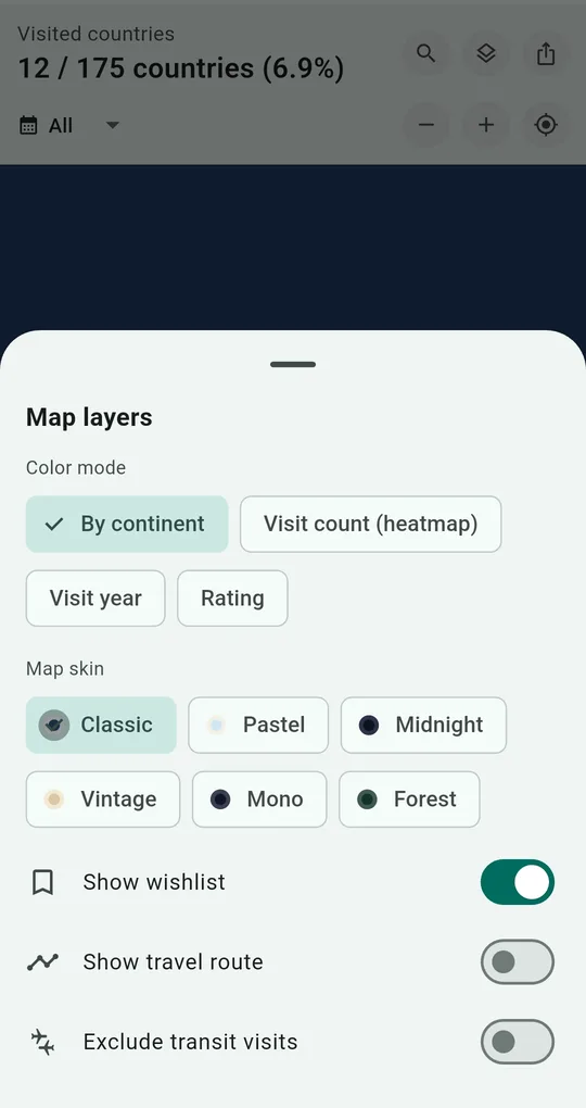
Choose a color mode and map skin
The map layers button switches between four color modes:
- By continent — one color per continent
- Visit count (heatmap) — darker for places you return to
- Visit year — when you went
- Rating — your favorites stand out
Map skins (Classic, Pastel, Midnight, Vintage, Mono, Forest), the wishlist overlay and the travel route line live here too.
Save or share as an image
Use the share button at the top right of the map to save the map as an image or send it straight to another app. For printing, export a high-resolution PNG.
Extras such as map skins unlock for good after one short ad.
Side-by-side comparison
| Scratch map | Google My Maps | Travel map app | |
|---|---|---|---|
| Small countries | Hard | Possible if you draw them | Zoom in and tap |
| Fixing a mistake | Not possible | Editable | Long-press to undo |
| Dates and notes | None | Typed into marker text | Date, rating, purpose, companions, photos, notes |
| Percentage of world visited | None | None | Calculated automatically |
| Sharing | Take a photo | Share a link | Save or share an image |
| Account | Not needed | Google account | Not needed |
FAQ
Do I need to sign up or log in?
No. There is no sign-up, no login and no location permission. Your records stay on your phone and are never uploaded; the internet is used only to show ads.
Will I lose my map if I change phones?
Export a backup file (JSON) and restore it on the new phone. You can also export a CSV that opens in Excel.
Is there an iPhone version?
It is currently available on Android through Google Play.
Travel Map: Visited Countries
No sign-up, and your records stay on your phone. Free on Android.