Two kinds of "gu"
Districts of Seoul or Busan, like Gangnam-gu, are autonomous districts with their own local government. Districts inside large cities, like Suwon’s Yeongtong-gu or Seongnam’s Bundang-gu, are administrative districts of their city. Counts of local governments leave the second kind out, but as a traveler, Yeongtong and Paldal in Suwon feel like different places.
The 256 areas of a travel map
The Android app "Korea Visited" follows the boundaries of July 1, 2026: 16 provinces and metropolitan cities, 256 cities, counties and districts, counting administrative city districts as their own cells. Suwon is 4 cells; Changwon is 5.
Changes on July 1, 2026
| Area | Change |
|---|---|
| Gwangju and South Jeolla | Merged into Jeonnam-Gwangju Special City |
| Incheon | Jung-gu, Dong-gu and Seo-gu replaced by Jemulpo-gu, Yeongjong-gu, Seohae-gu and Geomdan-gu |
| Hwaseong | Four administrative districts |
| Bucheon | Three districts |
Other areas have moved too, like Gunwi-gun joining Daegu in 2023. Boundaries keep changing, so treat official announcements as the reference.
Seeing it in the app
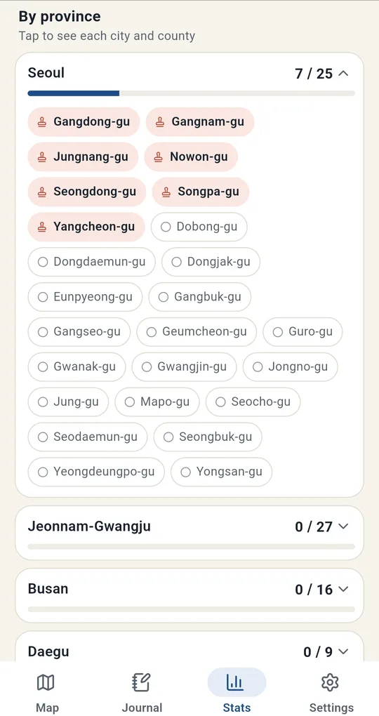
By province
"By province" on the Stats tab shows counts like "Seoul 7 / 25" and "Jeonnam-Gwangju 0 / 27". Tap one to see its areas.
Old records move automatically
Visits logged under the old boundaries are moved to the new map automatically. Where an area was split in two, like Incheon’s old Seo-gu, the app asks "Which district was it?".
FAQ
Can I color smaller neighborhoods?
No, the smallest unit is city/county/district.
Can I search by an old name?
Yes. See logging places under old names.
Korea Visited: Travel Map Log
No sign-up, and your trips and photos stay on your phone. Free on Android.